LiDAR stands for Light Detection and Ranging. It is a remote sensing technology that uses laser light to measure distances and create highly accurate 3D maps or models of objects and environments. The basic principle of LiDAR involves sending out laser pulses and measuring the time it takes for the laser to bounce back after hitting a surface. By knowing the speed of light and the time it took for the light to return, the LiDAR system can calculate the distance between the sensor and the object or surface.
LiDAR systems are commonly used in various applications, including:
Topographic Mapping: LiDAR is used to create high-resolution digital elevation models (DEMs) for accurate mapping of terrain and landscape features.
Forestry Management: It helps in assessing forest canopy structures, measuring tree heights, and estimating biomass.
Autonomous Vehicles: LiDAR is an essential sensor for self-driving cars, enabling them to perceive their surroundings and detect obstacles.
Environmental Monitoring: It aids in monitoring and analyzing changes in landscapes, coastal erosion, and glacier movements.
Archaeology and Cultural Heritage: LiDAR is used for aerial surveys to discover and document ancient ruins or archaeological sites hidden beneath vegetation.
Urban Planning and Infrastructure: It assists in urban planning, infrastructure design, and monitoring the structural integrity of buildings and bridges. Floodplain Mapping and Management: LiDAR helps in identifying and mapping flood-prone areas and managing flood risks.
LiDAR technology has rapidly advanced over the years, becoming more compact, affordable, and widely accessible for various industries and applications. It complements other remote sensing technologies like aerial photography and satellite imagery, providing valuable data for research, planning, and decision-making processes.
2. How Work Lidar ?
LiDAR (Light Detection and Ranging) works based on the principle of measuring the time it takes for a laser pulse to travel to an object or surface and bounce back to the sensor. The basic steps of how LiDAR works are as follows:
Emission of Laser Pulses: The LiDAR system emits rapid and short pulses of laser light, typically in the near-infrared spectrum. The laser emits thousands of pulses per second.
Pulse Reflection: The emitted laser pulses travel through the air until they encounter an object or surface in their path. When the laser hits an object, it reflects some of the light energy back toward the LiDAR sensor.
Time-of-Flight Measurement: The LiDAR sensor precisely measures the time it takes for each laser pulse to travel to the object and back to the sensor. It uses the speed of light to calculate the round-trip travel time accurately.
Data Collection: The LiDAR system records the time-of-flight measurements and the position of the sensor for each pulse. The data collected is referred to as a "point cloud," which consists of a large number of individual 3D points, each representing a specific location in the environment.
Post-Processing and Analysis: The raw point cloud data is processed and analyzed to create detailed 3D models or maps of the scanned area. The data can be used to generate various products, such as digital elevation models (DEMs), 3D visualizations, and vegetation classification.
It's important to note that modern LiDAR systems often use advanced techniques, such as dual-return and full waveform LiDAR, to capture more information about the environment. Dual-return LiDAR, for example, distinguishes between multiple returns from a single laser pulse, allowing for better discrimination of different objects and surfaces. Full waveform LiDAR records the entire backscattered waveform, which provides additional information about the characteristics of the scanned objects.
The high precision and accuracy of LiDAR make it a valuable tool in a wide range of applications, including topographic mapping, forestry, autonomous vehicles, archaeology, and environmental monitoring. Its ability to generate detailed 3D data sets quickly and efficiently has made it an indispensable technology for various industries.
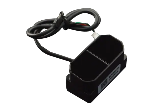
TFmini Plus Lidar Module
TFmini Plus, based on TFmini, is a single-point short-range LiDAR sensor. Inherited characters of low cost, small size and low power consumption from TFmini, TFmini Plus has greatly improved its performance — increasing the measurement frequency, reducing blind zone, improving accuracy and stability. Meanwhile, TFmini Plus introduces IP65 enclosures and optimizes various compensation algorithms, which has greatly expanded its application fields and scenarios.
TF03 Lidar(Long-range distance sensor) - 180m range
TF03-180 LiDAR is an industrial-grade long-range distance sensor. Its maximum detection range can reach up to 180m and it has an adjustable frame rate with a maximum of 1KHz. With an integrated compensating algorithm for outdoor glare and other interference, TF03-180 can work under a strong light environment, rain, fog, and snow conditions. It also has an aluminum alloy enclosure with IP67 water and dust resistance. Multiple built-in operating modes are included for the users to change its parameters and configurations to meet different applications.
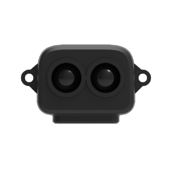
TF-Luna is a single-point ranging LiDAR, based on TOF principle. With unique optical and electrical design, it can achieve stable, accurate and highly sensitive range measurement. The product is built with algorithms adapted to various application environments and adopts multiple adjustable configurations and parameters so as to offer excellent distance measurement performances in complex application fields and scenarios.
Benewake is a technology company specializing in the development and manufacturing of LiDAR (Light Detection and Ranging) sensors and solutions. The company was founded in 2015 and quickly gained recognition for its innovative LiDAR products.
Key aspects of Benewake include:
LiDAR Solutions: Benewake focuses on providing a range of LiDAR products and solutions for various industries and applications. Their LiDAR sensors are known for their compact size, high accuracy, and reliable performance.
Product Portfolio: The company offers a variety of LiDAR sensors designed for different use cases. These products include the TFmini series (e.g., TFmini, TFmini Plus), which are small-sized LiDAR sensors used in robotics, drones, industrial automation, and other applications. Benewake also offers more advanced and powerful LiDAR products for specialized applications.
Technology Innovations: Benewake has been at the forefront of LiDAR technology innovations. They continuously improve their sensors' performance, expand their measurement range, and enhance their capabilities to meet the evolving needs of their customers.
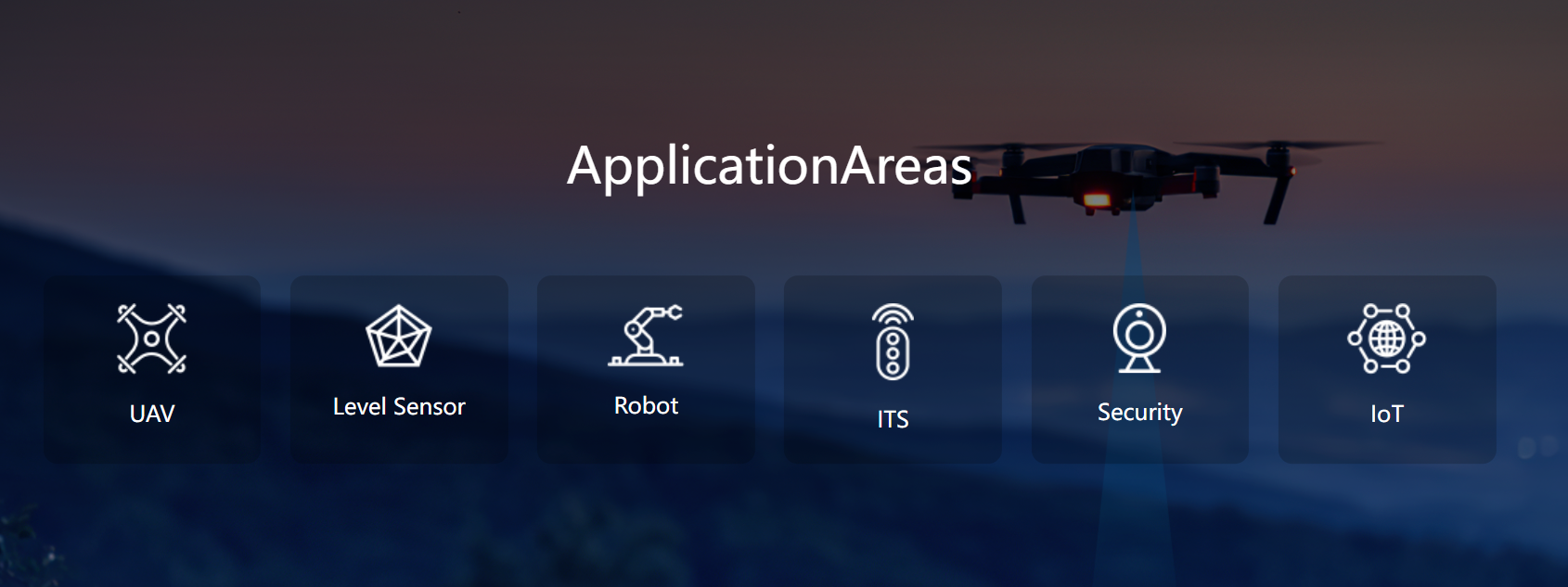
Applications: Benewake's LiDAR sensors find applications in various industries, including robotics, drones, autonomous vehicles, industrial automation, smart cities, security and surveillance, and more. Their products are used for obstacle avoidance, distance measurement, mapping, and environment sensing.
Global Presence: Benewake serves customers worldwide, and their products have gained popularity in both domestic (China) and international markets. They have established partnerships and collaborations with companies in different regions to expand their global reach.
Support and Community: Benewake provides technical support and resources to help their customers integrate their LiDAR sensors into their projects successfully. They also foster a community of developers and users to share knowledge and experiences.


 July 16, 2026