Exploring the SLAMTEC Mapper M2M2: Revolutionizing Laser Mapping and Navigation
The SLAMTEC Mapper M2M2 is an advanced laser mapping sensor designed to support cutting-edge simultaneous localization and mapping (SLAM) technology. Built for versatility, it offers real-time mapping, accurate positioning, and a range of innovative features that make it a top choice for applications like robot navigation, environmental mapping, and handheld measurements. In this blog, we’ll explore how this revolutionary sensor works and why it’s a game-changer for developers and engineers working on automation and robotics.
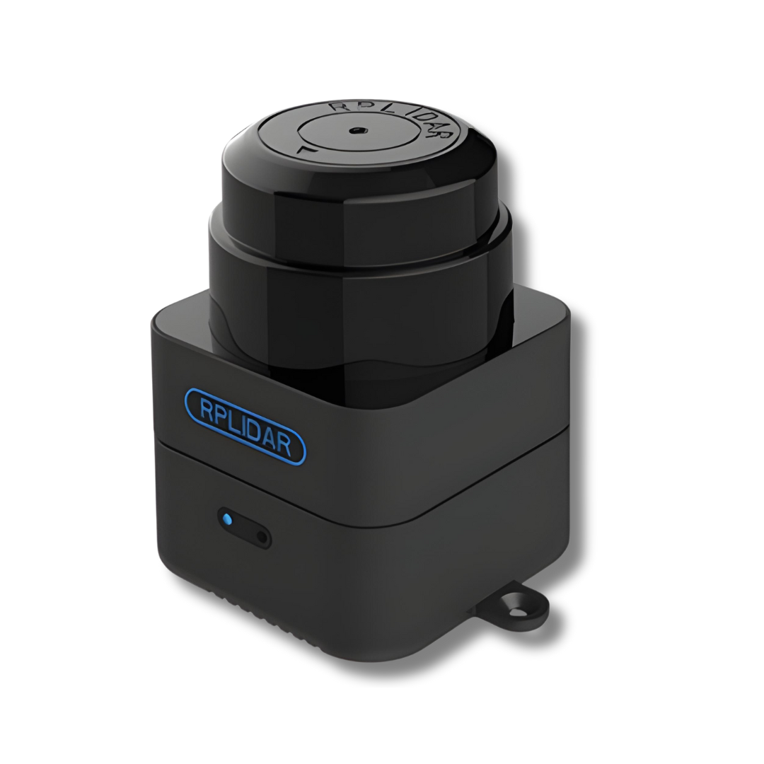
1. What Is the SLAMTEC Mapper M2M2?
The SLAMTEC Mapper M2M2 is an innovative laser mapping sensor that combines SLAM technology with a high-performance LIDAR (light detection and ranging) sensor. It captures and processes spatial data in real-time to create accurate, high-precision maps. The Mapper can handle environments up to 100,000 square meters in size and provides localization and mapping without the need for additional external sensors.
SLAM 3.0 technology for simultaneous localization and mapping.
SharpEdgeTM fine mapping technology for closed-loop correction and optimization.
9-DOF inertial navigation system for mapping in dynamic environments.
This sensor is perfect for robot navigation, environmental surveys, and complex mapping scenarios where real-time data is essential for efficient operation.
2. How SLAM Technology Enhances Mapping
SLAM (Simultaneous Localization and Mapping) is a critical technology that enables devices, such as robots, to understand and navigate their environment by creating maps in real-time while tracking their own location within that map. The SLAMTEC Mapper M2M2 uses a high-performance SLAM engine to fuse map data 10 times per second, ensuring real-time updates and high-precision mapping.
SharpEdgeTM Fine Mapping Technology
SLAMTEC's proprietary SharpEdgeTM technology ensures accurate closed-loop detection, which helps the sensor correct its map by recognizing previously mapped areas. This feature reduces errors over time, ensuring the best possible map quality.
3. Key Features of the SLAMTEC Mapper M2M2
360-Degree Mapping
The SLAMTEC Mapper M2M2 uses a motorized mechanism that rotates its LIDAR sensor, allowing it to capture a 360-degree map of its surroundings. This ability to scan in all directions makes it perfect for indoor and outdoor environments.
High-Speed Measurements
The Mapper can perform up to 9200 measurements per second, which, combined with a maximum detection range of 40 meters, makes it ideal for high-speed mapping applications. It offers a positioning accuracy of less than 0.02 meters, ensuring that even minor details are captured with precision.
Built-In 9-DOF Inertial Navigation System
One of the standout features of the SLAMTEC Mapper M2M2 is its 9-DOF inertial navigation system. This system allows the mapper to maintain accurate mapping even in fluctuating environments or when it is handheld. It adjusts for inclines, vibrations, and movement, ensuring consistent and high-quality data.
Wide application scenarios
The SLAMTEC Mapper M2M2 is versatile and can be used in various application scenarios, including:
Robot navigation and localization
Environmental mapping
Architectural engineering
Handheld mapping for surveying
4. Data Output and Development Support
Real-Time Data Output
The Mapper M2M2 can output real-time LIDAR scanning data, including map data and pose coordinates (x, y, theta), allowing developers to monitor mapping in real-time. With a data refresh rate of 10 Hz, it continuously updates position and location information.
Developer-Friendly SDK and ROS Support
To facilitate development, the SLAMTEC Mapper comes with a complete SDK (Software Development Kit) and supports integration with the ROS (Robot Operating System). This compatibility allows developers to easily acquire data, visualize maps, and integrate the Mapper into their existing systems. Whether you’re working on Windows, Linux, or ARM Linux, the Mapper is ready for seamless integration.
5. Why Choose the SLAMTEC Mapper M2M2?
High Precision Mapping
The SLAMTEC Mapper M2M2’s precision is its standout feature. The ability to map large areas with 0.05 m resolution and a 40-meter detection range ensures that it delivers highly accurate data across a wide range of environments.
Portable and Easy to Use
The Mapper M2M2 is designed to be compact, making it easy to integrate into mobile devices for handheld use or to mount on autonomous robots. With its plug-and-play functionality, users can get started with minimal setup by connecting the Mapper to a 5V DC power supply.
Safety Features
The SLAMTEC Mapper M2M2 utilizes a low-power infrared laser, which is both safe for humans and pets. It meets Class I laser safety standards and is designed to avoid interference from ambient light, making it suitable for both indoor and outdoor use.
6. Technical Specifications at A Glance
Feature
Specification
Maximum Detection Range
40 meters
Measurement Rate
9200 points per second
Mapping Area
100,000 square meters
Positioning Accuracy
< 0.02 meters
Mapping Resolution
0.05 meters
Power Supply
5V DC
Communication Interface
Ethernet, Wi-Fi
SDK Support
Windows, Linux, ARM Linux
Refresh Rate
10 Hz
Inertial Navigation
9-DOF system
Conclusion: A Versatile Solution for Modern Mapping
The SLAMTEC Mapper M2M2 is a versatile and powerful sensor that brings real-time mapping and localization to robotics, engineering, and environmental surveying projects. Its integration of SLAM technology, combined with its high-speed measurement capabilities and developer-friendly tools, makes it a top choice for professionals looking to develop high-precision mapping systems.
Whether you're building an autonomous robot, surveying a construction site, or creating advanced environmental maps, the SLAMTEC Mapper M2M2 is equipped to meet your needs with precision and ease.


 July 16, 2026