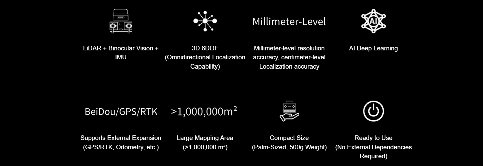
Building on over a decade of technological expertise, SLAMTEC has innovatively integrated LiDAR, vision, IMU, and deep learning to create the Aurora—a cutting-edge, all-in-one localization and mapping sensor. This sensor operates independently, providing high-precision 3D mapping and six degrees of freedom (6DOF) positioning both indoors and outdoors, right out of the box. With its unprecedented large-scale sensing range, Aurora provide precise spatial awareness, empowering smart devices to navigate complex environments with ease.
LIDAR, vision, and AI - seamlessly integrated for the first time
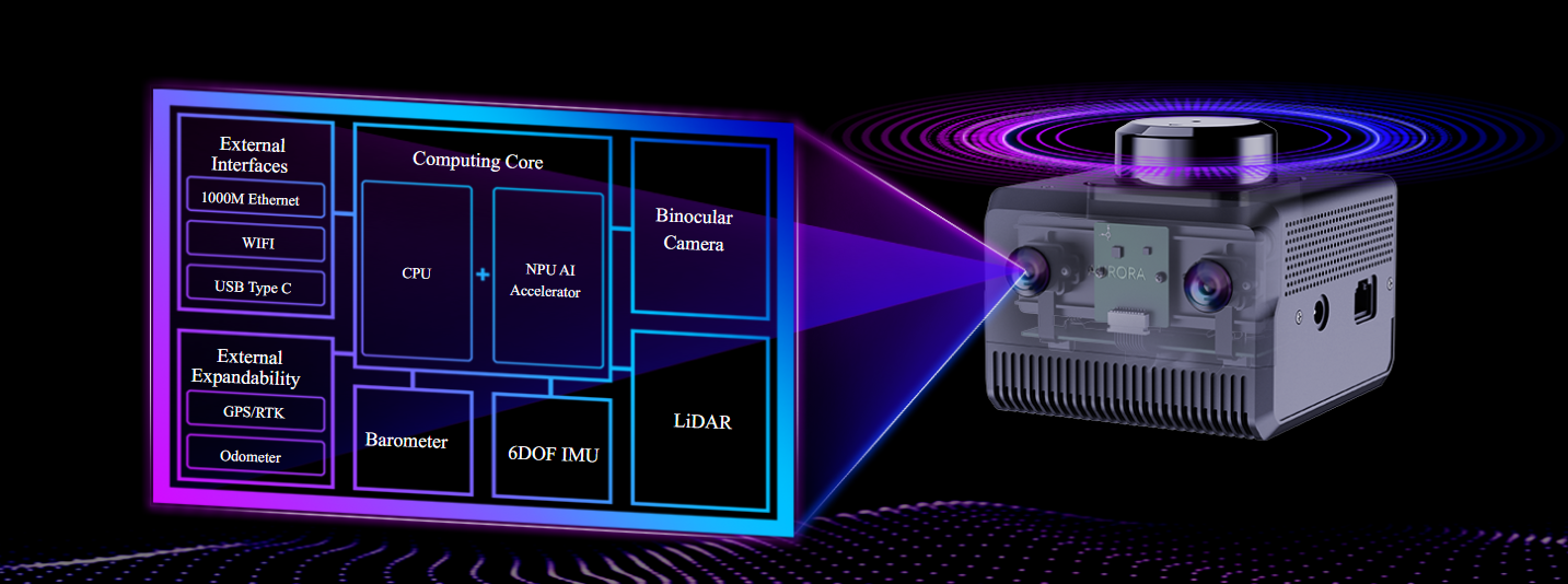
In the fields of autonomous driving and robotics, LiDAR and vision technologies have traditionally operated in isolation, often at odds with each other. However, we’ve taken a different approach, successfully merging the two to achieve technological harmony. SLAMTEC Aurora integrates 2D LiDAR, Binocular vision, 6DOF IMU, and an AI processor into one compact module, ready to use right out of the box.
AI + SLAM, Powered by Deep Learning to Tackle Tough Challenges
The first product-grade navigation and localization system in the industry to integrate deep neural networks, offering performance that surpasses traditional SLAM systems.
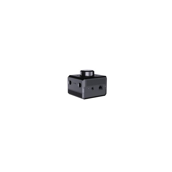
Compact and Sleek, Easy to Integrate
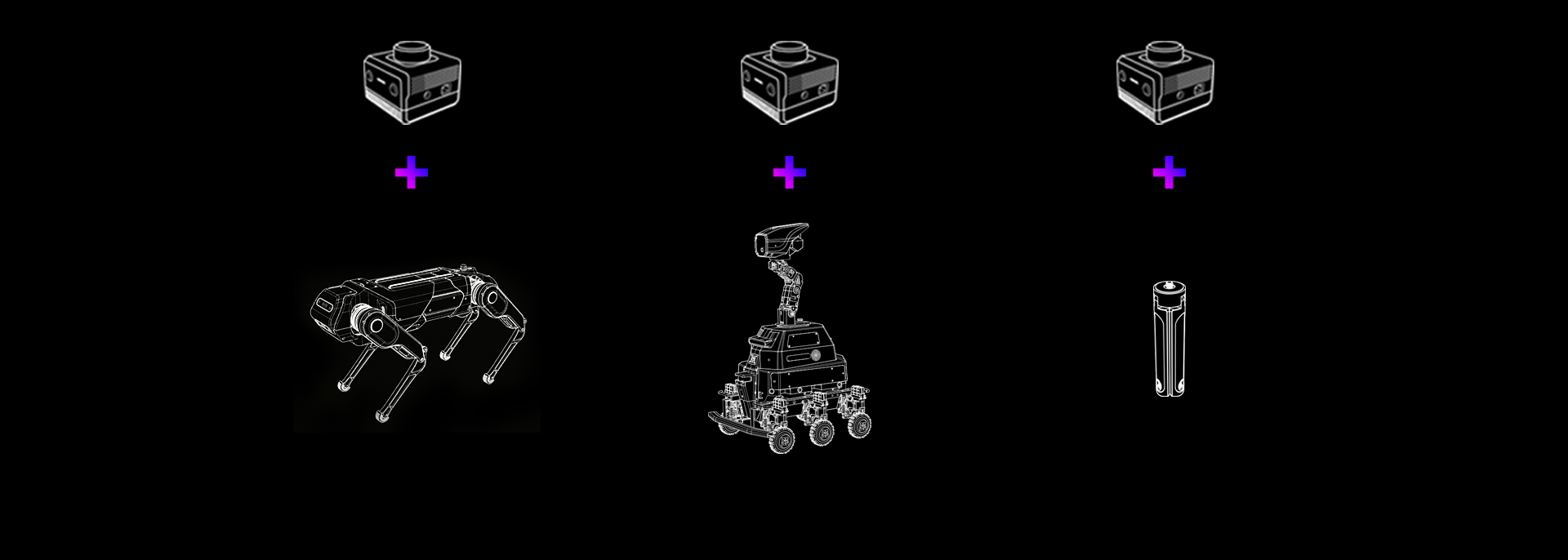
SLAMTEC Aurora’s compact design is a perfect match for embodied intelligence. It’s small and sleek, taking up minimal space while delivering powerful performance. Whether integrated into small robots or large systems, it easily adapts, becoming the ideal partner for embodied intelligence solutions.
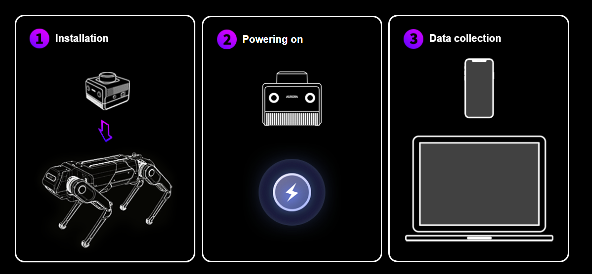
Three Simple Steps, Easy to Use
SLAMTEC Aurora is incredibly easy to operate, requiring just three steps to integrate into humanoid robots: Step 1, install; Step 2, power on; Step 3, start collecting data. Offering professional-grade performance at a consumer-friendly price, it leads the way in the new era of embodied intelligence. With exceptional value for money, Aurora delivers a whole new experience in localization and mapping, empowering tech products for the age of embodied intelligence.